Distance: 18 km
by bike
Duration: 1h
Difficulty : Average
Departure: SAUVETERRE-DE-GUYENNE
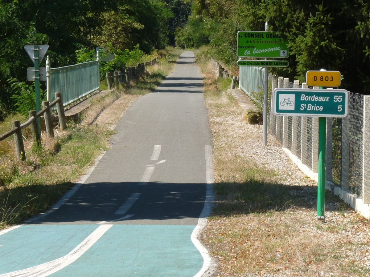
Vert
Campaigns
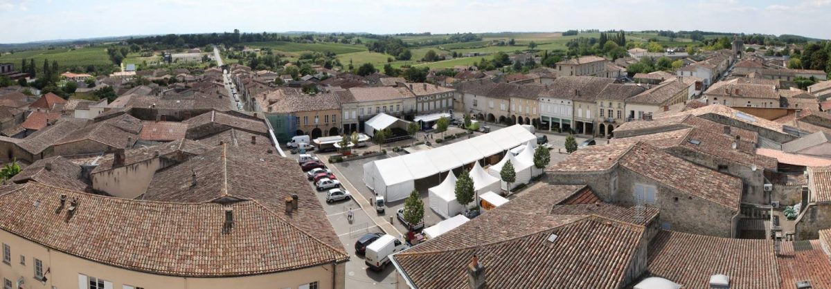
SAUVETERRE-DE-GUYENNE
From the Lapébie greenway, discover the vineyards, rural heritage, and the bastide of Sauveterre.
Your itinerary
1
Start of the Lapébie greenway
Turn right on the D230 for 400 m then turn left and straight ahead.

2
Crossing D671
Cross the departmental road and go opposite along the industrial zone. Straight ahead.
3
Locality Les Gays
At a place called Les Gays, at the T-junction, turn left then 150 m later right to the D670.
4
D670
At the crossroads on the D670 turn left, long hill then right towards the village of Puch
5
The Puch
Go along the church on your right and 150 m later turn left. Continue to the D129
6
D129
Turn left for 250 m then right.
7
Place called Focrose
At a place called Foncrose, turn right and continue to a T fork, turn left.

8
Place called Piquereau
Place called Piquereau, T-junction opposite a house, turn left.
9
Place called Mont Saint-Fort
Place called Mont Saint-Fort turn left and straight on to the D17

10
D17
Cross the D17 and take the road opposite to the D672.

11
D672
cross and take the road opposite. Go straight down towards the village of Saint-Léger de Vignague.
12
Saint-Leger de Vignague
In the village at the crossroads, turn right and straight on for 1,5 km

13
Place called Candale
At the crossroads turn right

14
Place called Bouey
Turn left for 400 m then right
15
Place called Bouey
Go down the slope, then go straight up to the boulevard
16
D670 Boulevard of November 11
Right then left rue Jean Monnet
17
St. Leger Street
Turn left rue St Léger then go around the square.
18
Rue du Petit Bordeaux
Go down the rue du Petit Bordeaux to the boulevard, on the left to join the Lapébie greenway.
Points of interest

Bastide of Sauveterre de Guyenne

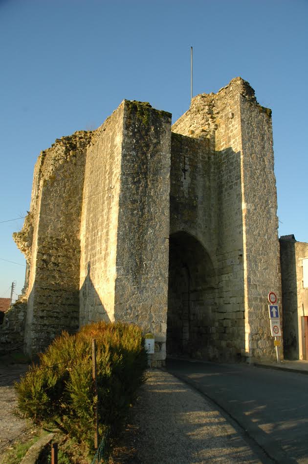
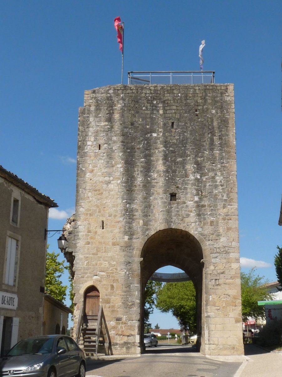
Porte Saint-Leger

Puch Church

Puch Church

Church of Saint-Léger de Vignague

Church of Saint-Léger de Vignague

Saint-Romain-de-Vignague

Church of Saint-Romain-de-Vignague