THE VERDON-SUR-MER
From Soulac to Lacanau, follow the superb shaded cycle paths of the Aquitaine coast to the Bassin d'Arcachon.
Browse the Pointe Médoc, a territory with many facets, depending on whether you cross the west coast or the estuary and the vineyards. This section of the route invites you to discover, among other things, the charm of the old villas of Soulac-sur-Mer, the smells of the pine forests, the Médoc freshwater lakes, the Cousseau pond, Lacanau-Océan... Large spaces of nature reserves and ocean beaches...
Browse the Pointe Médoc, a territory with many facets, depending on whether you cross the west coast or the estuary and the vineyards. This section of the route invites you to discover, among other things, the charm of the old villas of Soulac-sur-Mer, the smells of the pine forests, the Médoc freshwater lakes, the Cousseau pond, Lacanau-Océan... Large spaces of nature reserves and ocean beaches...
Your itinerary
1
Pointe de Grave/ Soulac-sur-mer (7,3 km – Family Level)
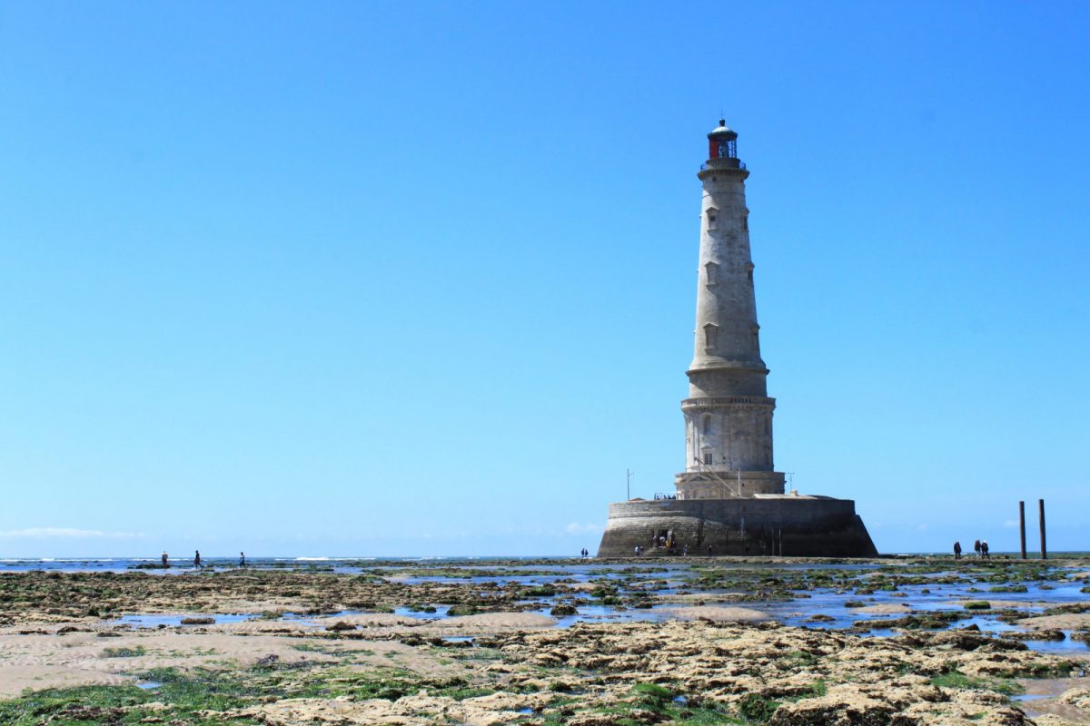
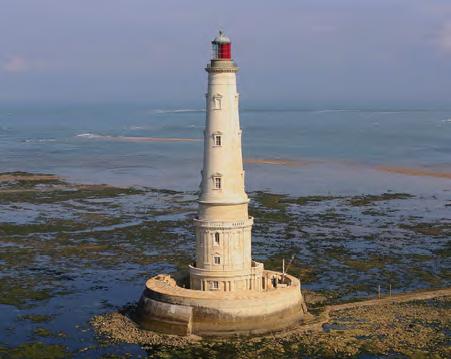
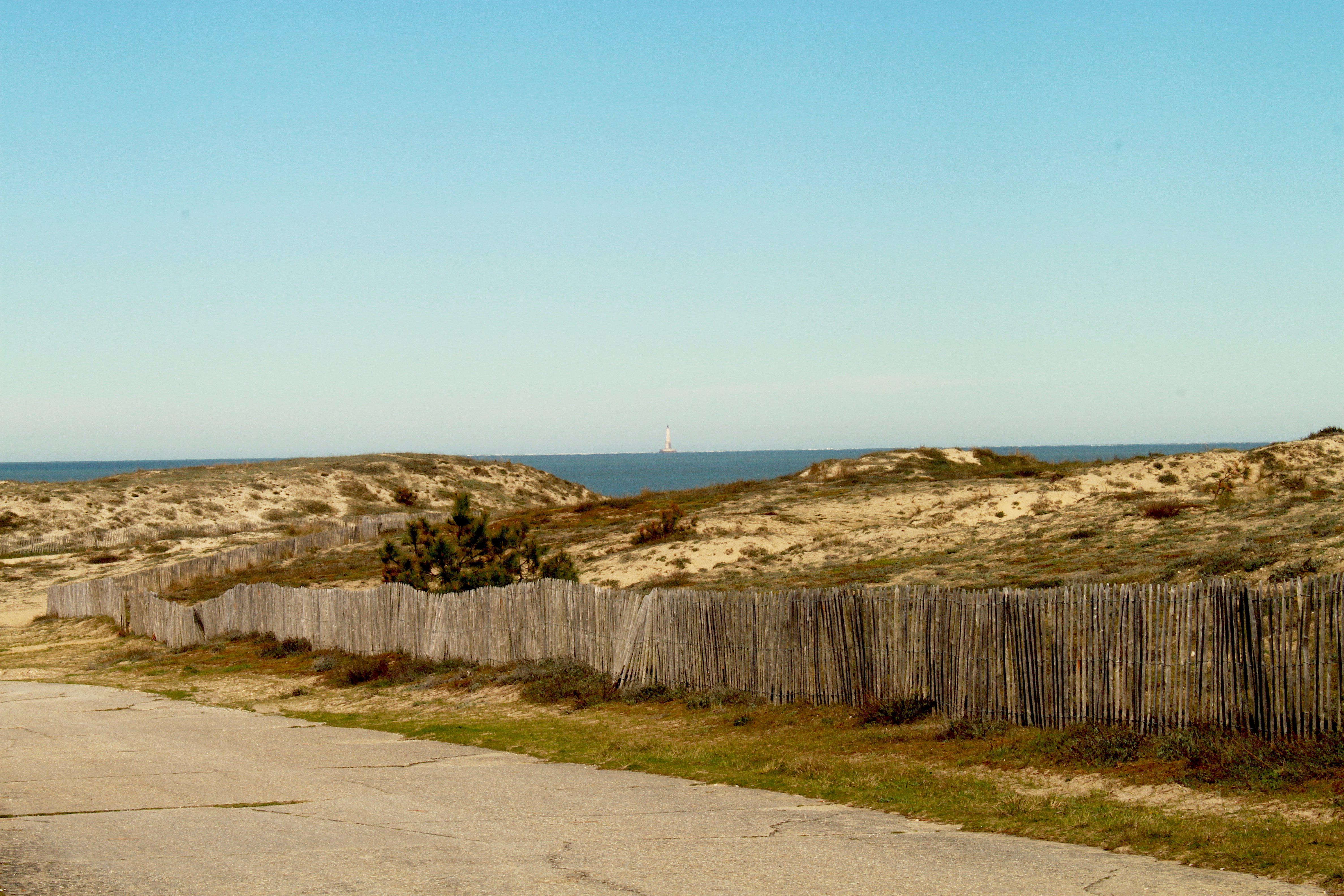
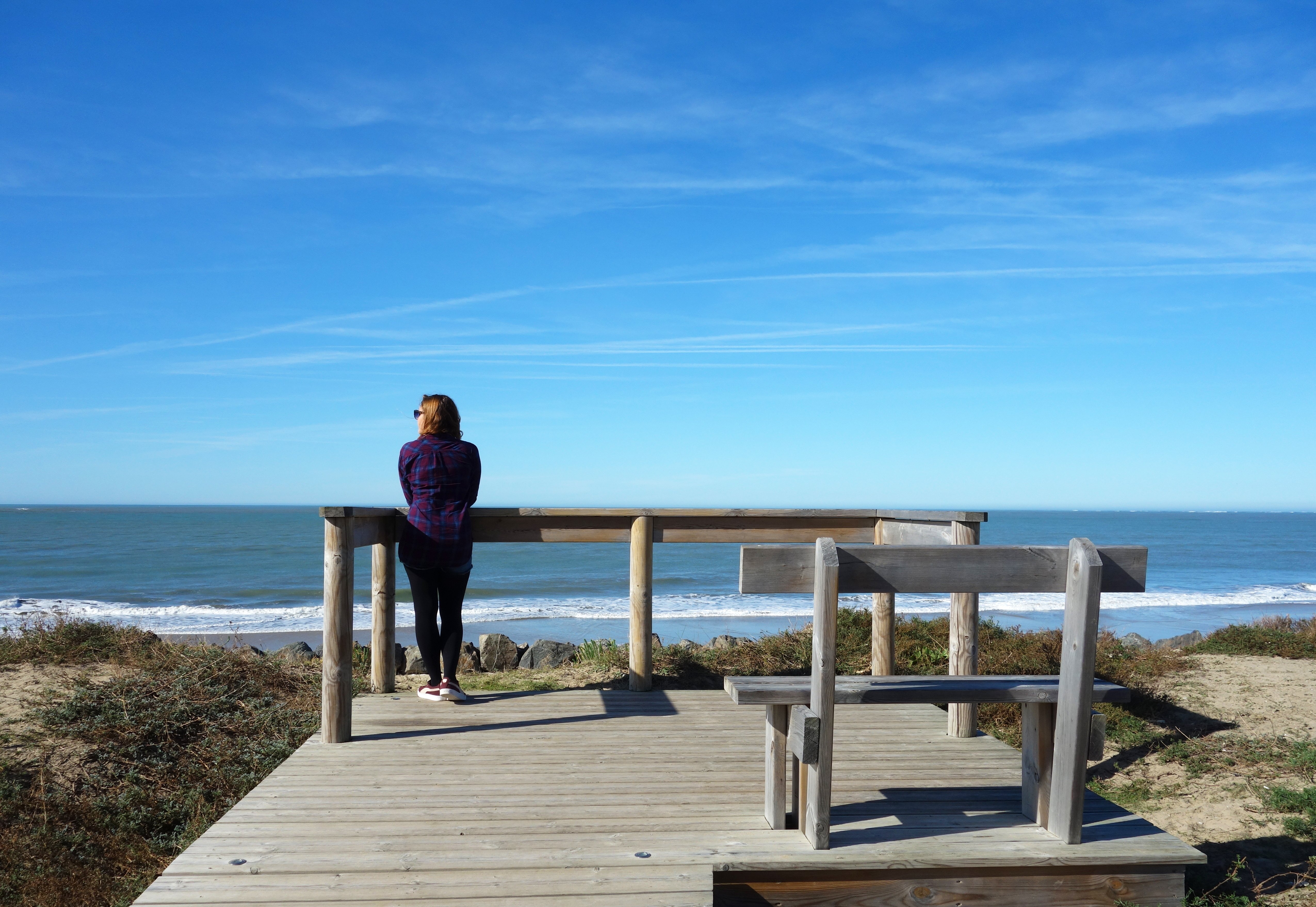
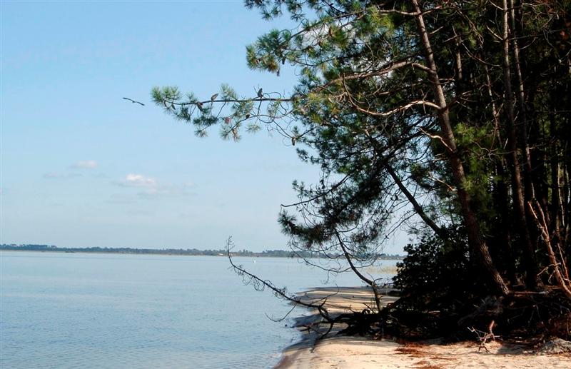
Whether you joined the Verdon-sur-Mer station from Bordeaux or got off the ferry from Royan, your Girondin journey begins at the start of the little Verdon tourist train, where you take the Pointe de Grave cycle path. Pointe de Grave, opposite the Cordouan lighthouse, the construction of which began at the end of the XNUMXth century, is the end of the Médoc peninsula. Its strategic position made it a place of battles and resistance, which culminated during the Second World War, in bitter fighting, on the heavy installations of the Atlantic Wall, of which many vestiges are still visible. The track runs along the railway line, then moves away from it to follow the dune cordon in a forest of holm oaks. You will enjoy beautiful glimpses of the ocean on what is undoubtedly the wildest and most protected part of the Aquitaine coast. You will arrive at Soulac-sur-Mer, in the Arros district, where the track runs along the side of the road.
2
Soulac-sur-mer/Montalivet (21,5 km - Family level)
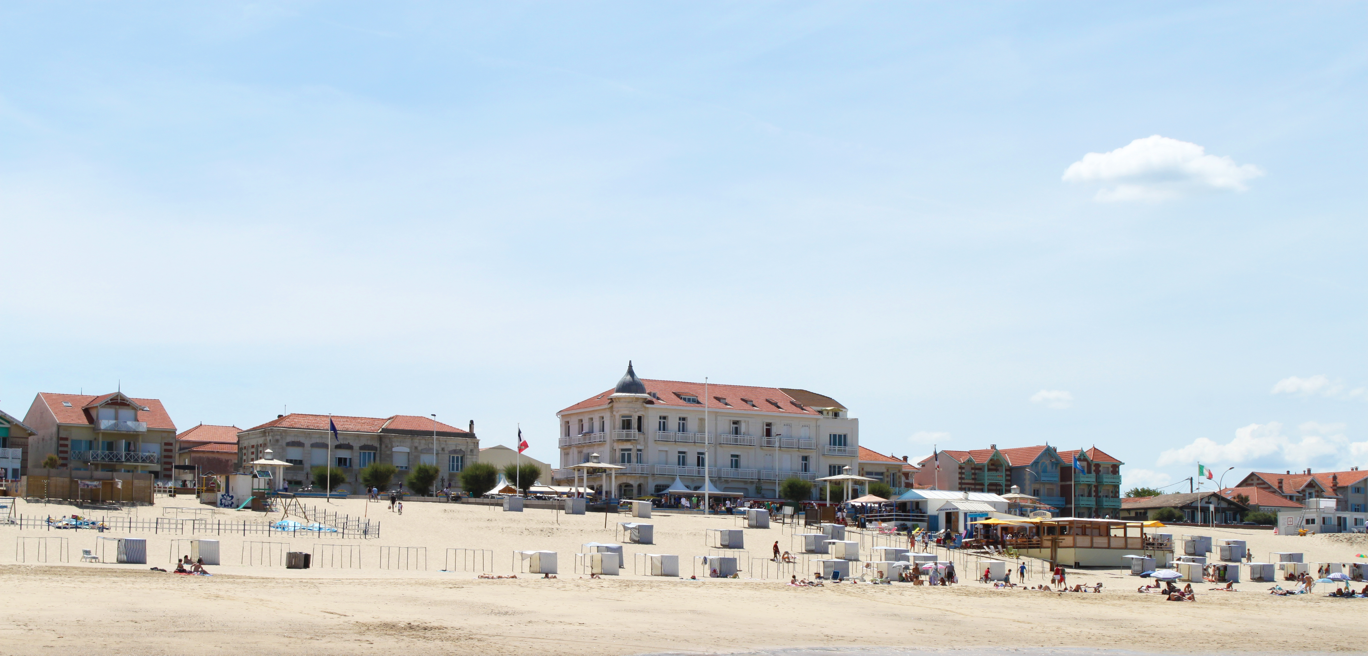
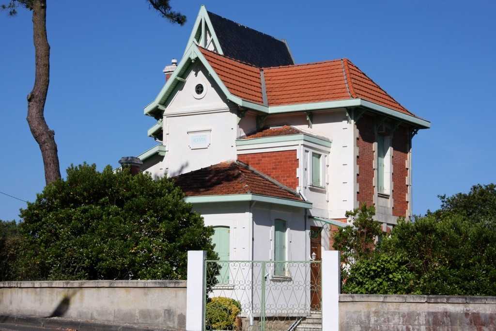
If you arrived via Soulac-sur-Mer station or if this is your second stopover, it is under the charm of its lively streets and its seaside villas that you take the track towards Montalivet. To the north of this stage of the Vélodyssée, swimming is yours, to the south a more forested route, very pleasant in good weather. Take the seafront, typical of the oldest seaside resort in the Médoc, until you find a new track that runs along the Amélie road. At Amélie beach, the path ends. Turn left then right to follow the road, again on a separate site to the tip of La Négade. Turn left, the track goes deep into the forest. You will now progress through the forest massif of the Landes de Gascogne, planted in the 250th century to fix the dunes and which constitutes both the landscape, the culture and the richness of a territory which extends over nearly 16 kilometres. right a little further (km 20) and continue south. The track that continues straight leads to Talais from where you can reach the Gironde estuary, its marshes, its small ports and emblematic squares. This wonderful walk is recommended. Be sure to admire a superb view of the estuary at the end of your journey. Your route then skirts the Gurp campsite (km 26), then, to the right, runs along the road towards Montalivet. Straight ahead you can reach Grayan-et-l'Hôpital. You walk along Euronat, a huge internationally known domain dedicated to naturism. At the next crossroads, before going straight into the forest, you can prefer to turn left to join Vensac and Queyrac and head towards the Médoc wine region. After a right turn (km XNUMX), you arrive at Montalivet.
3
Montalivet / Hourtin Plage (20,1 km - Family level)
Arrived at Montalivet, you walk along the street and turn towards the seafront. The track is interrupted. It then resumes on the right (km 29,7). A little further on, turn right towards Hourtin-Plage. The track which goes straight leads you to Vendays-Montalivet (Bourg). You advance in the forest of pines and cork oaks, of which certain old individuals are particularly spectacular and after a new chicane left/right, you arrive at the crossroads of the Pin Sec road (km 44,4). Continue straight until the junction with the departmental road which goes to Hourtin-Plage.

4
Hourtin beach / Lacanau ocean (31,8 km – Expert level)
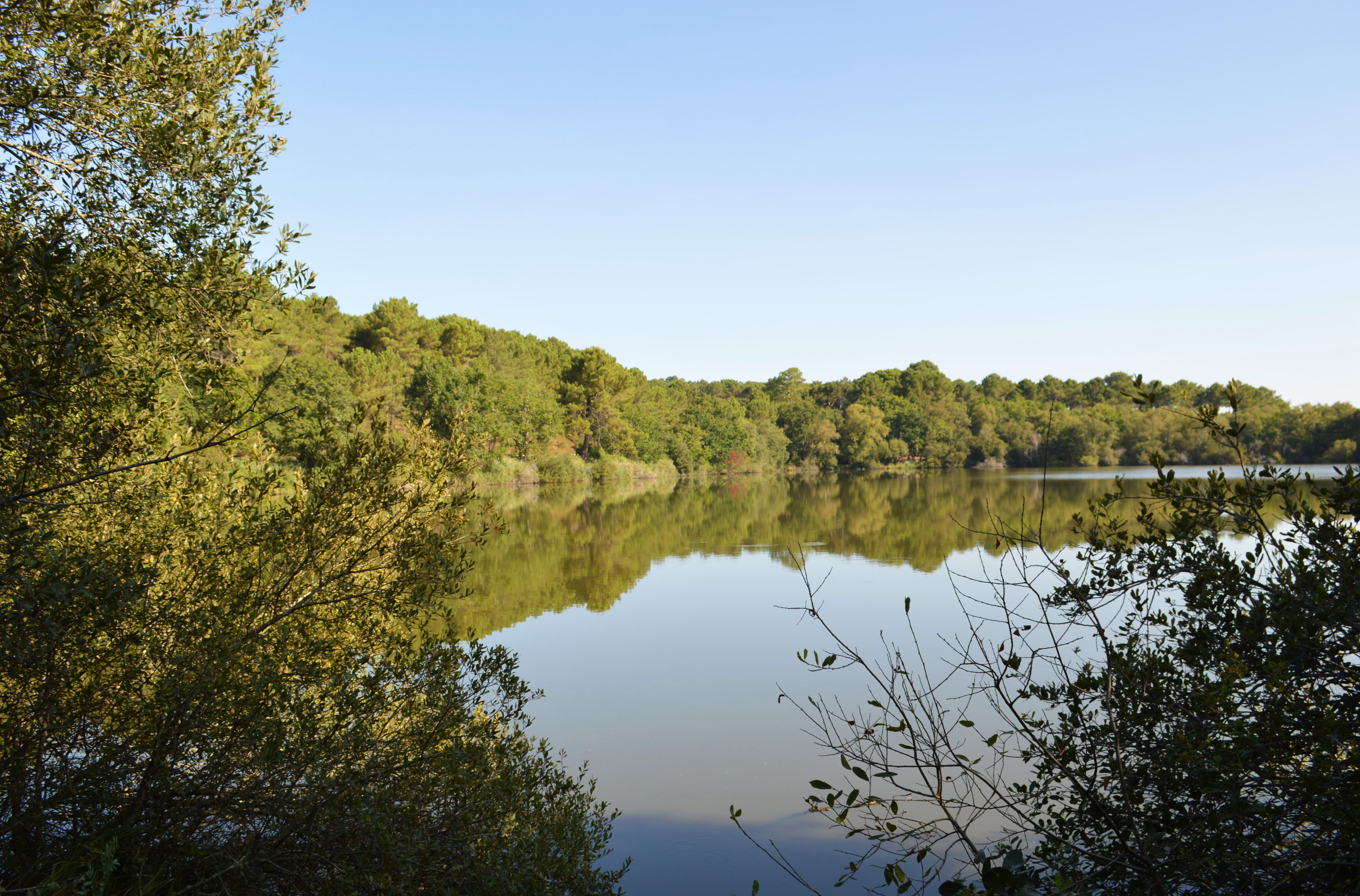
Take opposite, a little on your left, the forest road closed by a barrier. Follow the direction Carcans-Plage. This lane is closed to cars during the summer season and not very busy the rest of the time. However, it is advisable to be careful and to respect the rules of the road. Its width and surface are a guarantee of safety. A little further on, you arrive at a crossroads of tracks (km 50). If you turn left, go visit the Contaut lagoon. This small natural lagoon has been developed by the Departmental Council of Gironde so that visitors can admire its unique flora. In season, naturalist guides will help you discover its secrets. If you turn right, you arrive at Hourtin-Plage. The place is ideal for taking a break, taking a bath, a coffee, refueling or preparing for a new stage. From there, a track also joins Carcans-Plage, but it is very narrow (50 cm). Continue on the forest road which connects Hourtin-Plage to Carcans-Plage. You progress on this wide, well-surfaced track - secured by being closed to traffic in the summer season - where several crossroads indicate connections either to the right and the ocean, or to the left and the Carcans-Hourtin lake. You will find a dense network of tracks and forest roads with variable profiles, but often made up of narrow concrete tracks of uneven quality, intended more for mountain bikes. Those that lead you to La Gracieuse or Bombannes will make you discover the charms of the largest natural lake in France, 18 km long and 5 km wide. Just before the end of the forest road, you arrive at a crossroads of tracks. Turn left, direction Maubuisson. If you go to the right, you reach Carcans-Plage where you will find all the services to get off to a good start. However, by the beach, the connection with the South is ensured by a narrow track (50 cm). beautiful trail on its own site, hilly and wooded, surrounded by inland dunes and deep ravines. The landscape is superb and surprising. It is the consequence of a conflict dating back more than 5000 years between the old dunes, naturally wooded with oak trees, open towards the West and the recent dunes, open towards the East which were fixed by the plantation of pines. It is this event that created the natural lakes and explains the rugged terrain that you can admire. You pass near the Cousseau pond, a protected nature reserve where you will find naturalist guides and interpretive trails. The fauna and flora are unique and preserved. You come out on the Bordeaux-Lacanau cycle path, the oldest of the Gironde tracks (made in 1980 by the Departmental Council on the right-of-way of an old railway line), which you take to the right direction Lacanau-Océan. Pass a first roundabout, cross two small tunnels and arrive at a second roundabout where you turn left towards Longarisse. Pass in front of the Lacanau casino.
Full screen Close
Departure LE VERDON-SUR-MER
Points of interest

Estuary of the Gironde
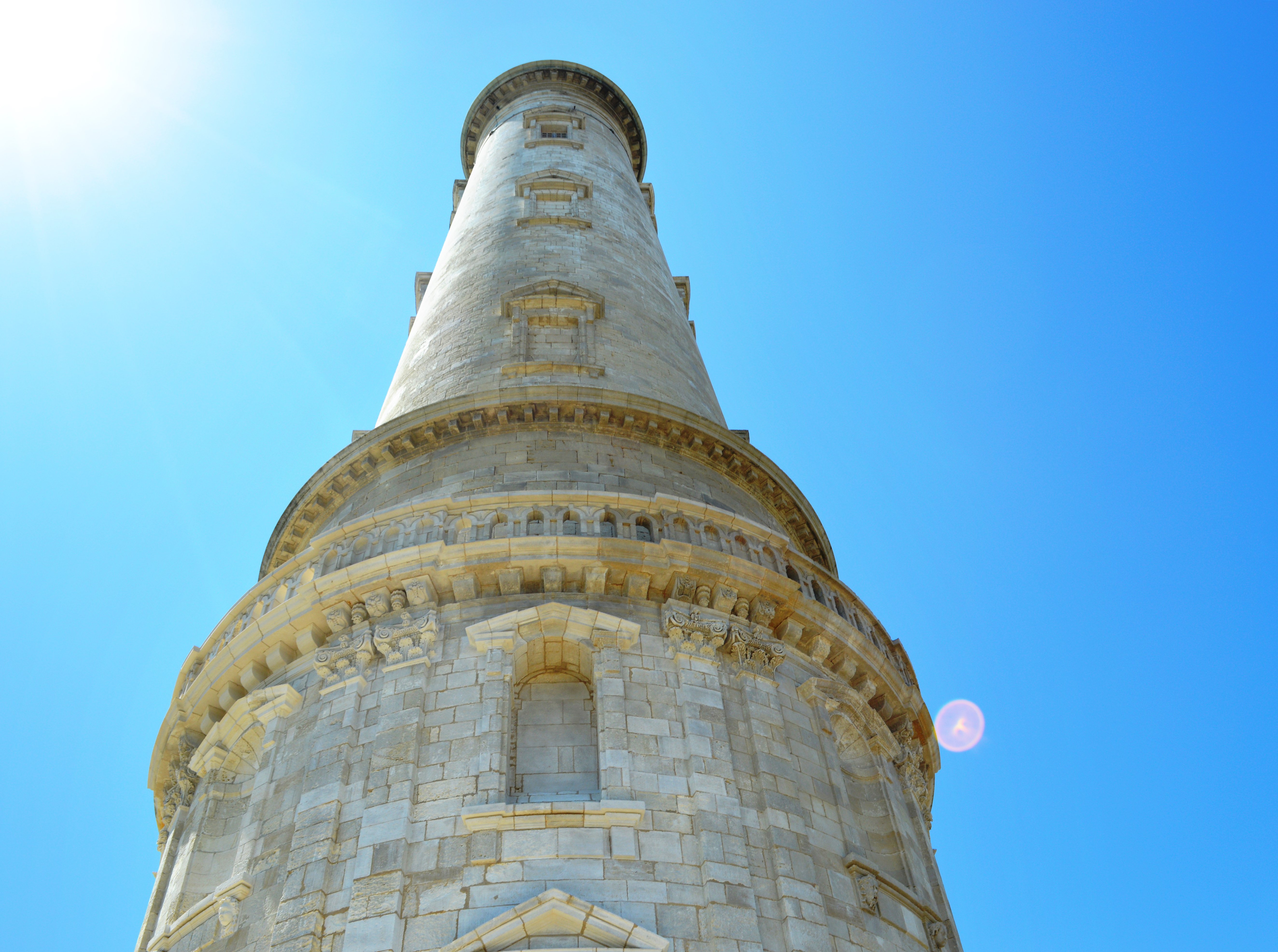
Cordouan Lighthouse

Soulac-sur-Mer
Amelie Dune
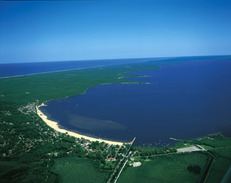
Lake of Carcans-Hourtin
Contaut Lagoon
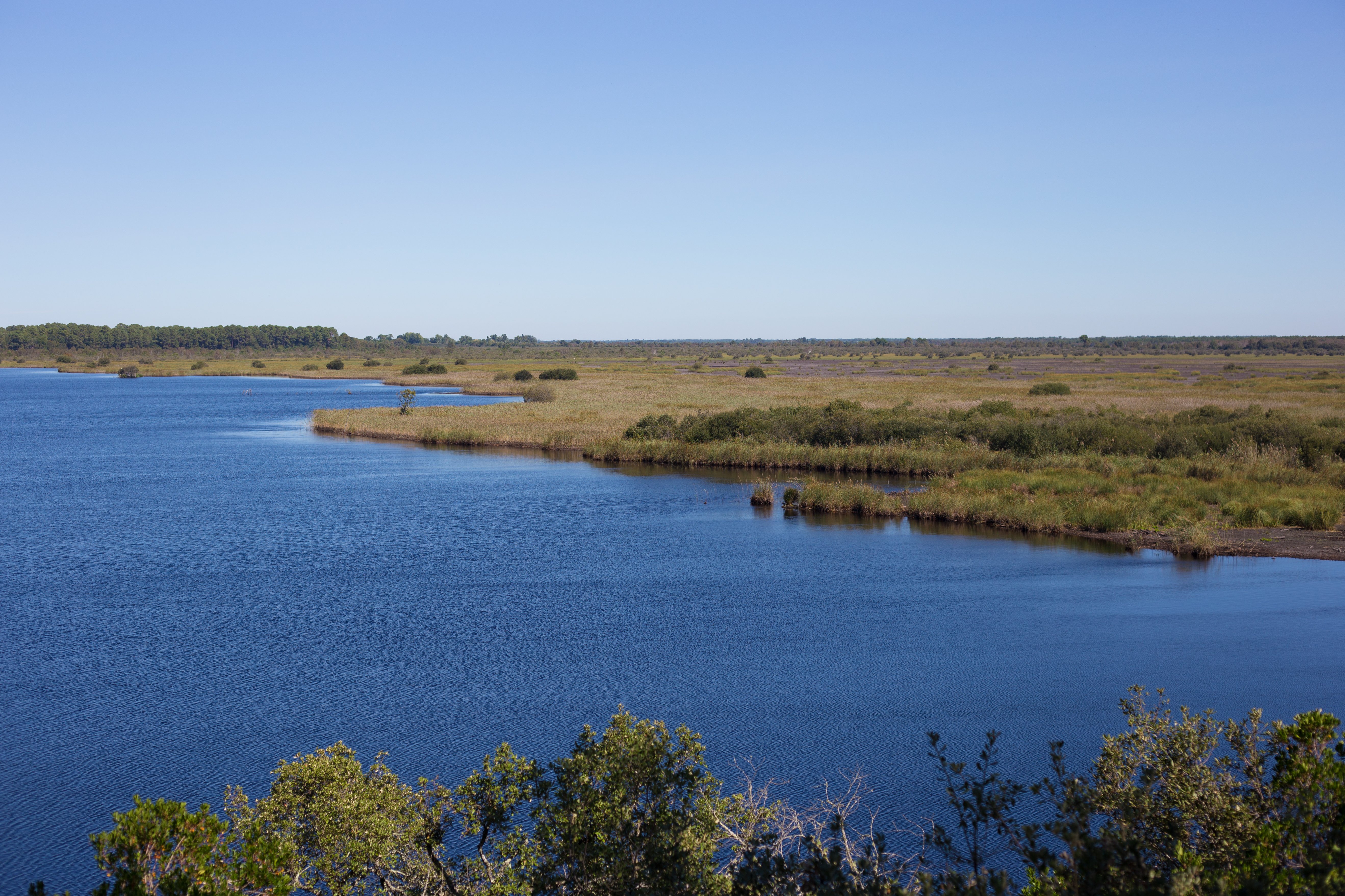
Cousseau pond nature reserve
Lacanau lake
Seaside resort of Lacanau ocean