Distance: 12 km
walk
Duration: 2h
Difficulty : Average
MOUNTAIN
Campaigns
MOUNTAIN
This walk from the Mountain will allow you to enjoy a magnificent view from the Butte de Calon: privileged observatory of the windmills and the wine-growing landscape.
Your itinerary
1
Step 1
Facing the church, take the secondary road (D244) on your right.
2
Step 2
At the "give way" sign, turn right.
3
Step 3
At the end of the street, continue on the left in the bend. Continue on this path until the next intersection.
4
Step 4
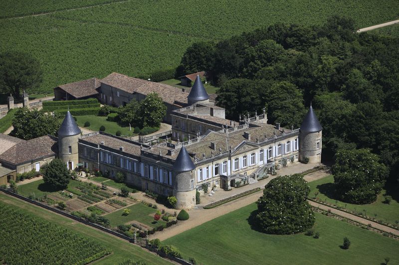
At the crossroads, turn right (indication “Château la Bergère”).
5
Step 5
Continue right at the next intersection. Stay on this "path of the mission cross" until you reach the Saint-Georges church (pass in front of Ch. la Bergère).
6
Step 6
Turn right and go past Ch. Saint-Georges. Turn left then continue straight. You enter again in the village of Montagne. Continue straight ahead on the lane that passes behind the Saint-Martin church (slightly turning left). Continue to the next intersection.
7
Step 7
Take the first right on the road that goes up to a place called "Arriail". Continue on this road until you reach the departmental road higher up (D122), towards Ch. Calon.
8
Step 8
At the departmental road, turn left towards Ch. Calon and continue to the next lane going to the right.
9
Step 9
Go right towards Ch. Maison Neuve Coudroy.
10
Step 10
Then take the first uphill path on the left. Continue to the end and turn left (yellow-green markers).
11
Step 11
Walk a few meters and take the first path going to the right.
12
Step 12
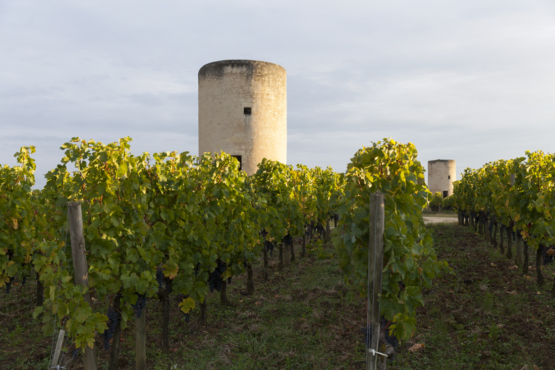
You arrive on the site of the mills of Calon. Join the road opposite. At the road, turn right and continue to the 3rd mill. Take the path on the right towards “boucle des moulins”. Continue downhill until you reach a paved road (green marker).
13
Step 13
At the road, turn right and continue to the next crossing.
14
Step 14
At the departmental road, turn right.
15
Step 15
Turn left on the downhill path that you have already taken earlier. At the bottom, cross the road to continue opposite.
16
Step 16
Continue down to the left and continue straight between the trees and the vines.
17
Step 17
At the end, continue up the path to the right.
18
Step 18
At the top, turn left and continue to the next intersection, at the entrance to the hamlet.
19
Step 19
At the intersection, continue to the right until the next crossing. Cross the departmental road to continue on the road almost opposite.
20
Step 20
Continue on this road. Then, take the wine-growing landscape interpretation trail, and cross the Bois de Bonde. (It is possible to shorten the route here by taking the path going to the right and continuing straight until you reach the crossing of the D244, where you will turn right to reach the village).
21
Step 21
Continue to the left.
22
Step 22
Continue to the right to enter the wood.
23
Step 23
Continue straight until the departmental. At the intersection, continue straight. At the next intersection (at the stop + sign direction "Mountain") turn right. Then take the first path on the left. Pass in front of the Ch. des Tours. At the end, turn right and go around the building on the left to join the D244 route. Turn left to return to your starting point.