Distance: 21,9 km
walk
Duration: 6h
Difficulty : Average
Elevation: 6 D +
PREIGNAC
White and red (GR®)
Around water (canal, stream, lake, marsh, ...)
PREIGNAC
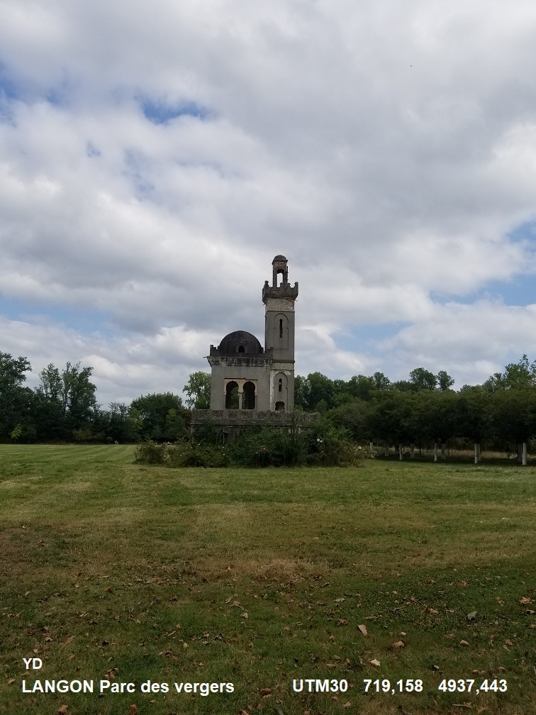
On the GR®6 between Preignac and Caudrot, the hiker passes the Sauternes vineyards then follows the banks of the Garonne on the quays of Langon, in front of its Saint-Gervais Church.
Walkers who wish to complete this hike in 2 days will find all the amenities in Langon. Experienced walkers stop at the picnic area.
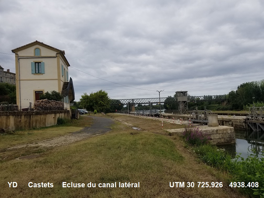
After crossing the village of Saint Loubert, arrival at Castets and Castillon, with the Hamel castle, the Garonne side canal and its locks. Once you have crossed the Garonne, and before reaching Caudrot station, pass through this village via the charming Place des Tilleuls.
This route is offered to you by the Regional Hiking Committee. From a station or TER bus stop, it allows you to join a walking or hiking route and take an ecomobility ride!
Walkers who wish to complete this hike in 2 days will find all the amenities in Langon. Experienced walkers stop at the picnic area.
After crossing the village of Saint Loubert, arrival at Castets and Castillon, with the Hamel castle, the Garonne side canal and its locks. Once you have crossed the Garonne, and before reaching Caudrot station, pass through this village via the charming Place des Tilleuls.
This route is offered to you by the Regional Hiking Committee. From a station or TER bus stop, it allows you to join a walking or hiking route and take an ecomobility ride!


Your itinerary
1
From Preignac station to the GR®6
Step not located on the map
From Preignac train station, take avenue Grillon for 150m then continue straight on rue Henri de Bournazel then rue Henry de Lur-Saluces for 750m. At the crossing of the D113, follow it for 30m on the left then cross at the Saint-Vincent Church. Continue on rue du port for 150m and continue on the GR®6 on the right.
2
Route on the GR®6
Step not located on the map
Follow the red and white markings of the GR®6 to Caudrot.
3
From the GR®6 to Caudrot station
Step not located on the map
To connect Caudrot station from the GR®6, take the roadway path on the left for 200m to the D227.