Distance: 18,6 km
walk
Duration: 4h
Difficulty : Easy-to-use
Departure: BLAYE
Vert
Around water (canal, stream, lake, marsh, ...)
Campaigns
BLAY
On the Compostella road from Tours, a 18.6 kilometer walk between the landscape of the Blayais vineyards and the Gironde estuary, the largest estuary in Europe!
Your itinerary
1
The start
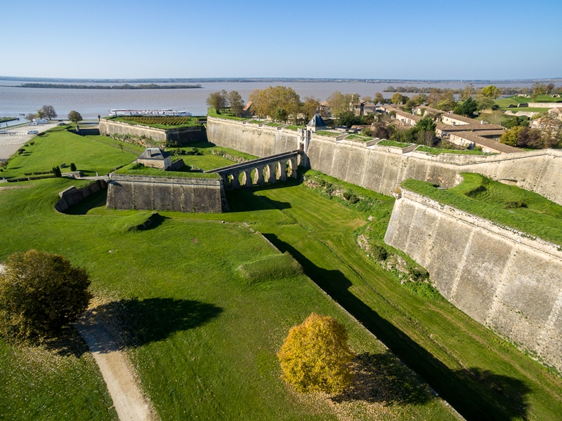
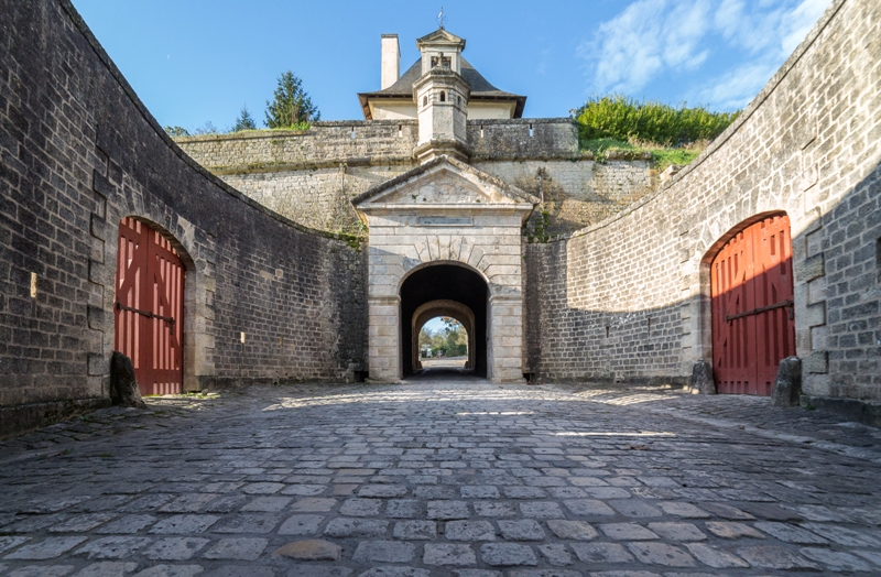
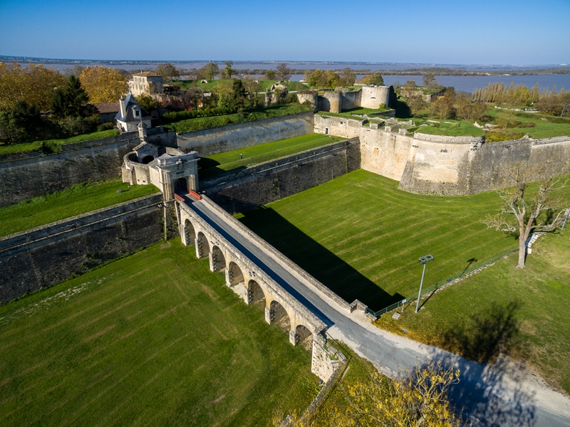
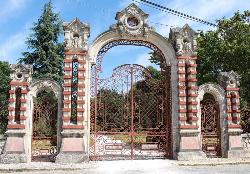
Your starting point is located in front of the Blaye tourist office. Enter the citadel of Blaye through the Dauphine gate then exit through the Royal gate. Take rue Paul Raboutet then turn left. As soon as you see a wooden bollard between two houses, take this path to the right. You then engage in a charming path bordering the back of the houses, in the middle of the gardens and the henhouses. Continue up the paved road.
2
Step 2
At the arrow gate, turn left then take the first road on the right towards the “hospital delivery” sign. A little further, you walk on a gravel path. Go straight.
3
Step 3
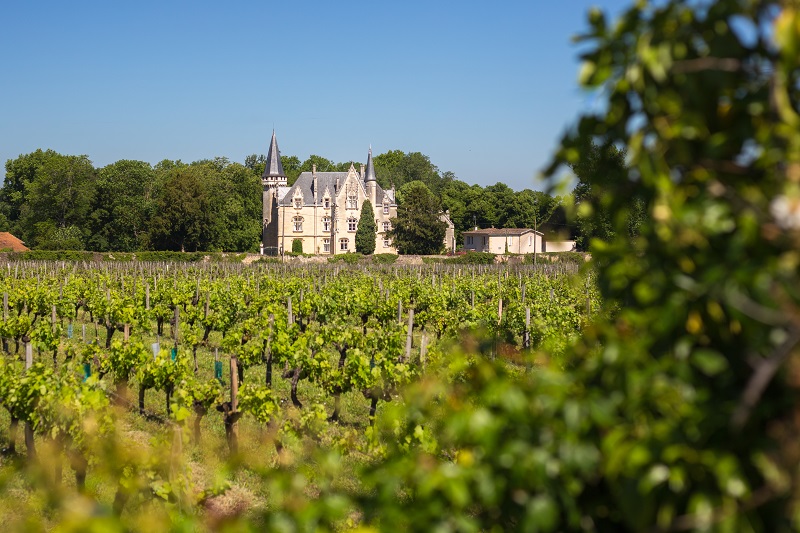
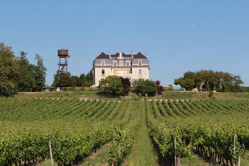
Arrived at the paved road, take the dirt road between the stone walls. You take the jacquaire path of the Voie de Tours marked by specific signage on the beacons. From this moment, you benefit from many glimpses of the Gironde estuary on your left. You dominate this landscape of water and marshes for a long time and overlook the Château La Grange.
4
Step 4
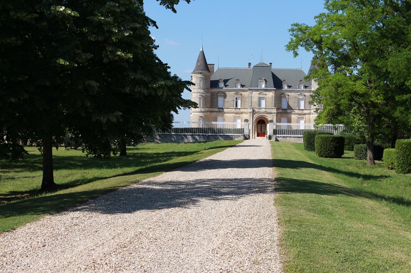
After about two kilometres, you reach a place called “La Brousse”, named after the castle that stands in front of you. Continue on the paved road and turn right at the level of the castle in the "path of the 3 mills", then again right, leaving on your left the "path of the vines".
5
Step 5
You climb towards the plateau in a landscape of vineyards typical of the landscapes of Blayais. The views over the Estuary and the Médoc are spectacular. Turn left at the beacon and continue straight, leaving the “dead end” sign on your right.
6
Step 6
Arrived at the arrowhead, turn right then immediately left to reach Saint Genès de Blaye. You pass in front of the cemetery where benches will allow you to take a short break.
7
Step 7
Before entering the village, turn right on the "D 137" (caution, traffic). After the exit sign, go up to the calvary and take the paved road to the left. In the first bend, continue straight on the gravel path and go along the agricultural building of the “Prieuré” castle.
8
Step 8
Continue your walk in the middle of the vines to an arrow holder installed under an oak tree. There, turn left towards the tarmac road which you follow left again, then right at the crow's feet towards Saint-Genès-de-Blaye. After the hamlet, turn right onto a gravelled path at the foot of an electric pole.
9
Step 9
After 350 m, take the path to the left between the rows of vines. The views of the hillsides and the wine estates are superb.
10
Step 10
Arrived on the paved road, turn right, then first left. You then climb regularly on a hillside crossing the places called “La Valade” and “Pellegris”, dominating the estuary.
11
Step 11
At the exit of Pellegris, continue straight in the direction of Château Segonzac. Turn right and go down to the D255.
12
Step 12
Be careful you will cross the D255 which is a very busy road. You are now walking on a dirt or limestone road and you will turn left on another dirt road.
13
Step 13
When you have passed the Château Marquis de Vauban turn left. At the stop sign turn right then once you have passed the fire brigade and you have crossed the roundabout continue along the hedge towards the citadel. Take the dirt road which crosses the grass, called glacis by Vauban. If you wish, you can return to the citadel or take the small path which extends along the glacis and return to Porte Dauphine. On your right do not miss the remains of the abbey Saint Romain, where Roland de Roncesvalles was buried.

Points of interest
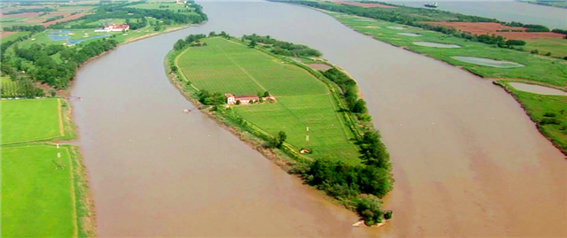
Estuary of the Gironde
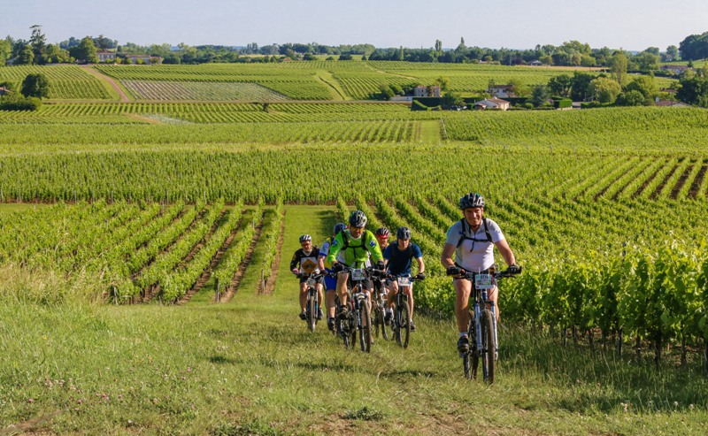
The Blaye Côtes de Bordeaux vineyard
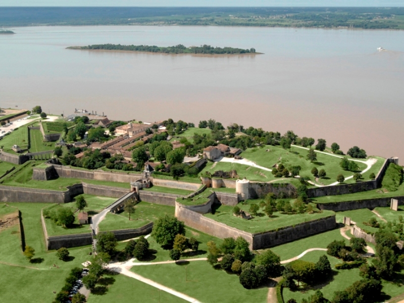
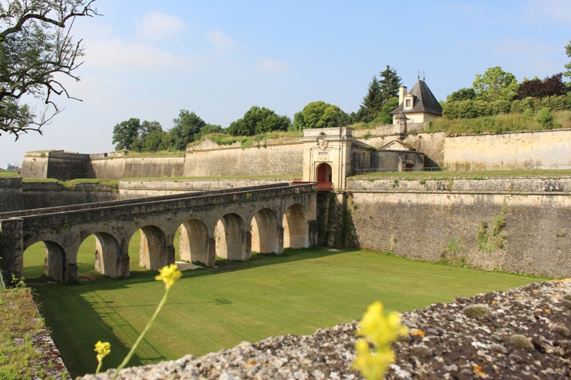
Citadel of Blaye